Frontierra is an environmental geospatial consultancy that utilises geospatial data and satellite monitoring to analyse and evaluate nature and climate-related risks and opportunities, with specific expertise in biodiversity and deforestation.
Since 2020, we have been enabling financial institutions and corporates to accurately and efficiently understand their impacts and dependencies, ensuring they can comply and disclose with the latest ESG regulations and frameworks, whilst also meeting consumer and shareholder expectations.
Lewis to provide a graph, spreadsheet or piece of analysis from the platform for this section
How we work
Frontierra develops tailored solutions to suit the needs of our clients. We typically operate as an extension of our clients' teams, developing specialised solutions that will work with existing processes and systems, and provide expert advice to not only identify risks, but to also advise on what the risks mean to the business and how they are best managed.
We provided complete, up-to-date and global coverage of portfolios, operations and supply chains which combines:
Where we work
Map to be provided.
Key Focus Areas
Drag the slider handles left and right to see the extent of the deforestation.
East Kalimantan, Indonesia
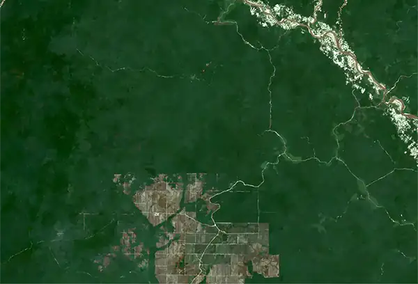
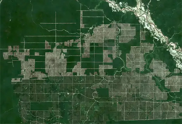
Large scale deforestation for palm oil plantations in East Kalimantan, Indonesia.
Imagery © 2020 and 2024 Planet Labs PBC. All use subject to the Participant Licence Agreement. This data has been provided under the NICFI Satellite Data Program.
Bacalar, Mexico
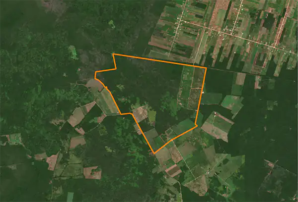
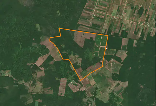
140 hectares of deforestation for soy production in Bacalar, Mexico.
Contains modified Copernicus Sentinel data.
Nature & Biodiversity
Explainer here?


Climate change
Explainer here?


Describe this interactive map
Etiam in nulla nec arcu condimentum maximus. Integer mauris dui, venenatis quis fringilla vitae, tristique nec risus. Sed aliquet tincidunt felis, non sagittis turpis tempor eget. Nunc leo sapien, posuere quis mi sed, dignissim congue nulla. Curabitur a urna vitae turpis eleifend varius vitae sit amet urna. Nunc nec venenatis libero. Duis tincidunt imperdiet mi sed tempor.